Markus Becker from the German Spiegel Magazine wrote about waves in the North Sea some time ago. At that time, Low Britta swept across the Baltic Sea, the North Sea and northern Germany with wind speeds of up to 156 kilometers per hour. In the area of the North Sea islands, the storm also reached hurricane force in places. News agencies reported wave heights of up to 17 meters in the North Sea. Coastal waves on the Baltic Sea were up to 9 meters high.
These kinds of messages come very rarely. And the waves we experience on the North Sea and Baltic Sea are often not higher than 1.5 to 2 meters. We have seen this at the Kiel Coastal Regatta a few weeks ago. The forum baltic sea gives us an example here:
| Wind Force 4 BF | |
|---|---|
| Wind speed: | 5.5-7.9 m/sec, up to 28 km/h, 11-15 knots |
| Countryside: | moderate breeze, pennant stretched, loose paper flies |
| Sea: | light, agitated sea, quite common occurrence of white foam heads, breaking sea roars |
| Sea state strength: | 3 |
| Wave Height: | 0,75-1,5 m |
| Wave Length: | to 50 m |
Coastal Waves in the Baltic Sea: How does a wave actually build up.
It happens in different phases.
Wind swirls water particles: Wind is created by the equalization of pressure between high and low pressure areas. Gradually, the wind attacks the water at the surface and swirls the water molecules in a circular path. The wind energy is transferred to the water. More at the top than at the bottom. The more water particles are swirled, the more agitated the sea.
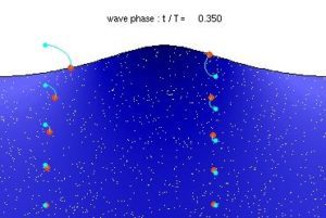
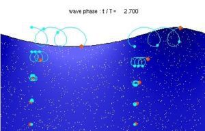
Here is the whole Video. The wind drives the wave forward and the crest of the wave is created. Gravity then pulls it back into the trough of the wave before the next crest is formed and breaks again at the crest. When the wave begins to break, the first white caps appear
Waves are created by winds. But how is the height of the wave determined?
- Wind speed: Check your wind app. If the wind is strong, you will probably have to expect stronger waves. This means that the wind is significantly faster than the crest of the wave.
- Free wind path: Likewise, the wind has a free path and can sweep over the wave over a wide area and for a long time. No obstacle or detour that would somehow slow it down (fetch).
- Wind duration: The time over which the wind has blown over the fetch
- Water depth
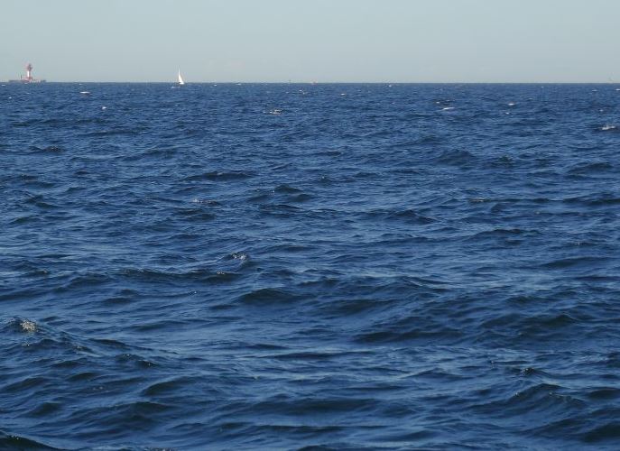
How big will the wave be?
Now, when you check the weather report the night before your trip, look at the following and estimate the following:
Your rowing – route, the strength of the wind, the duration of the wind, and the area over which the wind will sweep at one time. The greater or longer these three variables are, the greater the swell and the period – that is the time, between two waves. Here you can see wind and swells – in Realtime
Visual control of the swell:
Before you start rowing, take a look at the area. Most Coastal Boats row at a distance of 500m to 1000m from the shore. Depending on the depth of the water, expect swell. These are the incoming waves created by a storm far away.
Note the period: Period – – this is the time, between two waves. The wave period is an indicator of how much energy the waves carry. The longer the period, the larger and also more powerful the waves will be when they hit land; moreover, the waves then usually reach into more shielded bays.
Swells with a period of ten seconds or less are often referred to as windswells. These occur relatively close to the coast and are often still disorderly when they reach the shore – rowers and especially surfers on the German coast can tell you a thing or two about this.
Coastal waves in the Baltic Sea: rowing at the coast
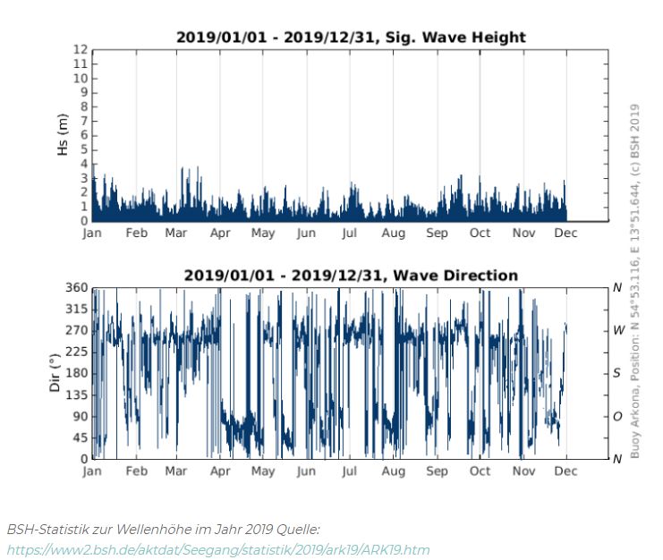
The biggest Coastal Rowing area in Germany is probably the Baltic Sea. What about waves there? An example: The average wave height at Timmendorfer Strand can be 2.5m, in Wustrow, just before Rostock about 2.5 – 3m. The following graphic from the Federal Maritime and Hydrographic Agency (BSH) shows a wave height of up to 3 meters off the coast of Rügen from the year 2019.
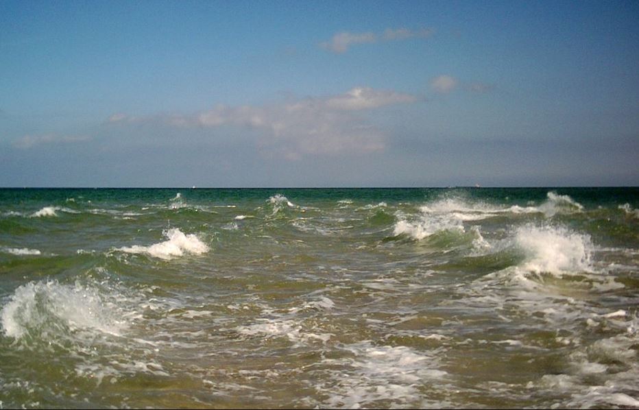
 Waves are building up.
As the wave approaches the shore, it begins to grow. Until the wave is as high as the water under it is deep. At this exact point, the wave begins to break: The lower part of the wave slows down a bit due to the friction on the bottom, while the upper part of the wave is still fast and thus breaks. The profile, i.e. the shape of the substrate, determines exactly how the wave breaks. The steeper the bottom, the steeper the wave and the more violently it will build and break.
Summary:
The further the distance the winds travel above the water surface, the larger the waves. For rowers in Germany, this is reassuring but not necessarily safer. However, we can expect that neither the North Sea nor the Baltic Sea will experience excessively high waves. The area of attack of the wind on the water is too short. This is especially true for the Baltic Sea. The fetch is relatively short.
Be careful at low tide: Water depth: Waves break depending on the depth of the water. The Baltic Sea shows only a few meters tide difference. Still, they break earlier (further out) when
- the period is short
- the underwater topography is flat
- onshore wind blows
Waves break later when
- The wind blows offshore
- When sandbars or the water suddenly becomes shallower
- The waves are long periodic
If you want to do coastal rowing in Europe and feel the waves, you should go to the Atlantic coast. But there is never one hundred percent certainty. More than three days in advance, the wave forecast is like a game of chance.

 Waves are building up.